Geodesign
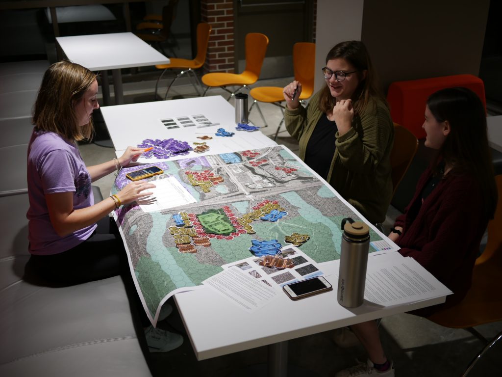 UF students play a table top strategy game about urban planning along the Matanzas River in St. Augustine, Florida.
What is Geodesign?
“Geodesign is a method which tightly couples the creation of proposals for change with impact simulations informed by geographic contexts and systems thinking, and normally supported by digital technology.” – Flaxman and Ervin, 2010
Geodesign leverages monitoring, measuring, modeling, mapping, machine learning, and land use managing (M6) technologies to assess and adapt built environments and design scenarios along pathways for a more prosperous and productive future. If you’re interested in problem solving and using technology to manifest a more resilient world, the SBE geodesign specialization may be a great option for you.
SBE Skillsets
Beyond the core curricula, SBE majors pursuing a Geodesign Specialization learn diverse spatial and temporal analytical and decision-support skills, such as the following:
- Proficiency with geospatial mapping software
- Python scripting
- Data modeling
- How spatial data influence decisions
- Knowledge in data science
Geodesign Fields of Work
Geodesigners pursue jobs in a variety of professional fields, such as the following:
- City Planning and Local Governments
- Design Firms
- Engineering Firms
- Consulting and Corporations
- Risk Mitigation and Planning
- Community Development
People Powered Projects
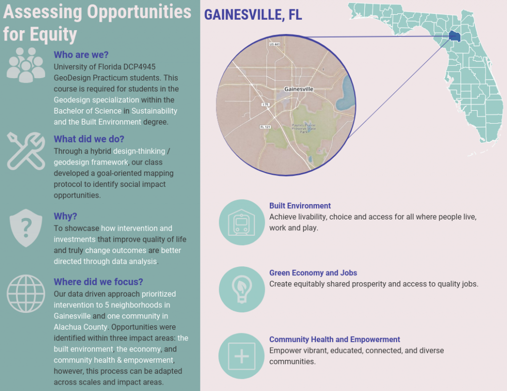
These skills are empowered through software and applied research projects affiliated with the Geo-Facilities Planning and Information Research Center, or GeoPlan Center. This prominent entrepreneurial Center, was established in 1984 as a response to local and statewide needs for a teaching and research environment in Geographic Information Systems (GIS). The Center is affiliated with the Department of Urban and Regional Planning, in the University of Florida’s College of Design, Construction and Planning. Click the GeoPlan Center logo to learn about their current projects.
Learn More About Geodesign
Geodesign integrates technology and data science to make sustainable decisions for communities, corporations, and nonprofits. Coursework includes several hands-on experiences where students collaboratively build solutions and apply them in energy, natural systems, to improve livability, and business.
Opportunities for Geodesign Students at UF
Any UF student pursuing a BSSBE undergraduate degree may choose to specialize in Geodesign and enjoy extensive opportunities for academic growth and professional development. The links below provide additional details about the Geodesign Specialization and
Geodesign Alumni & Testimonials
Learn more about the Geodesign experience from past student bios, ArcGIS Story Maps, and short video testimonials showcased on the alumni page.