
Career development, on your time.
Learn spatial analysis techniques from wherever you are. Our graduate certificate program is completely online and designed for working professionals.
This graduate GIS certificate program features critical thinking coupled with technical spatial analysis skills using modern GIS software, methods, and applications. Students will dive into the robust capabilities of GIS for visualization, analysis, modeling, and sharing of geographic information. Students can build their credentials and take advantage of the increasing demand in the job market for GIS-specific expertise.

Program at a Glance
CURRICULUM
• 4 courses / 12 credit hours
• Complete in 1 – 1.5 years
• Online and asynchronous
TUITION AND COST
• $675 per credit hour (includes tuition and fees)
• Approximate total cost for certificate: $8,100
ADMISSIONS
• Bachelor’s degree
• 3.0 GPA
• Resume/CV
• English proficiency, if international
• No GRE required
Note: the GIS Certificate for Urban and Regional Planners is a self-supported specialized program. If you are currently enrolled at the University of Florida, reach out to see if you are eligible to pursue.
CURRICULUM
The Online GIS Certificate program is 12 credit hours. There are 3 required courses (9 credits) and one elective course (3 credits). Courses are 16 weeks long. The certificate can be completed in approximately 12-15 months. All courses are taught by faculty in the UF Department of Urban & Regional Planning.
The courses are completely online and asynchronous, so you can watch the lectures and materials at your own pace. Assignments are typically due every week or two.
Course List
There are four required courses (12 credits). These courses cover the foundations of GIS, geospatial modeling (vector and raster-based), software proficiency with ArcGIS, introduction to GIS Data and Project Management, Web Mapping and Publishing. Publicly accessible course syllabi are hyperlinked below.
REQUIRED COURSES (3)
1. URP 6270: Introduction to Planning Information Systems (3 credits) — Spring
2. URP 6278: Web Mapping & Visualization (3 credits) — Summer (URP 6270 pre-req.)
3. URP 6275: Intermediate Planning Information Systems (3 credits) — Fall (URP 6270 pre-req.)
UPPER-DIVISION ELECTIVE (1)
Choose one:
• URP 6271: Automation for Geospatial Modeling and Analysis (3 credits) — Spring
• URP 6272: Urban Spatial Analysis (3 credits) — Spring
• URP 6280: 3D Geospatial Modeling and Visualization (3 credits) — Spring

Course Syllabi
Note: students in the GIS Certificate are limited to enrolling ONLY in the courses listed in the curriculum above. Navigate to College of Design, Construction and Planning > Urban and Regional Planning to search for the courses above.
WHY GIS?
GIS technology plays a crucial role in analyzing spatial data and supporting evidence-based decision-making. GIS professionals use geographic data to solve real-world problems in fields such as urban planning, environmental management, transportation, and public health.
The ability to visualize and interpret spatial relationships has become invaluable, particularly as we deal with challenges like climate change, resource allocation, and infrastructure development. By acquiring GIS skills, you’ll be equipped to contribute to important initiatives that shape our future.
A GIS certification opens doors to a variety of career paths across multiple industries. Here are just a few examples:
• Disaster Management: GIS professionals are involved in emergency response planning, flood modeling, and damage assessment post-disasters.
• Urban and Regional Planning: GIS professionals help cities and towns plan for sustainable growth, manage land use, and design transportation networks.
• Environmental Science: GIS is crucial for managing natural resources, tracking wildlife, and assessing environmental impact.
• Public Health: GIS is used to map disease outbreaks, optimize healthcare resource allocation, and analyze environmental health risks.
• Transportation and Logistics: GIS plays a key role in route planning, supply chain management, and infrastructure maintenance.
Whether you’re looking to enhance your current skill set or transition into a new career, our GIS Certificate Program provides the expertise you need to succeed in this growing field.
GIS in Action

Military Grid Reference System
A letter-and-number code system used by the military and emergency responders to find exact locations on Earth.

15 Minute City – London
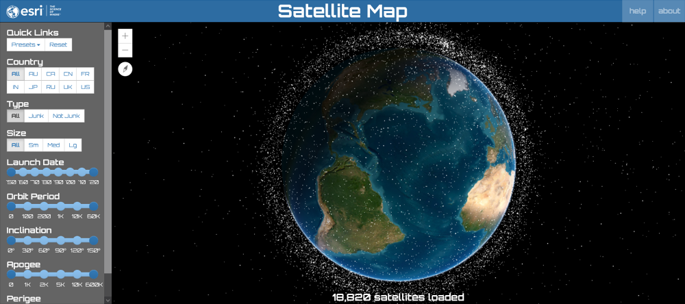
For more examples of GIS in practice, you can explore projects from the UF GeoPlan Center — a research center in the department focused on geospatial data and planning — including the Florida Geographic Data Library and Sea Level Scenario Sketch Planning Tool, both of which feature geospatial data resources and public web maps. You can also browse the Projects page for even more examples.
CONTACT



Kyle Dost, AICP
GIS Certificate Program Director
Contact regarding: program administration