
RESILIENT JACKSONVILLE
Advancing Community Resilience through Watershed Planning for Jacksonville, Florida
Exploring how the relationship between housing, environmental conditions, and community well-being shapes resilience in Jacksonville creek neighborhoods.
Understanding Resilience Through Connected Systems
The Jacksonville research explores how social, environmental, and spatial conditions are interconnected and collectively shape community well-being and resilience. Building on this understanding, socio-ecological modeling and transect analysis examine these relationships across regional and neighborhood scales, connecting broader system patterns with physical and place-based conditions.
Why It Matters?
Community well-being is shaped by interconnected social, environmental, housing, and neighborhood conditions. Understanding these relationships through data, community knowledge, and place-based investigation helps identify vulnerabilities and supports more equitable and locally responsive approaches to watershed restoration and planning.
Our Approach
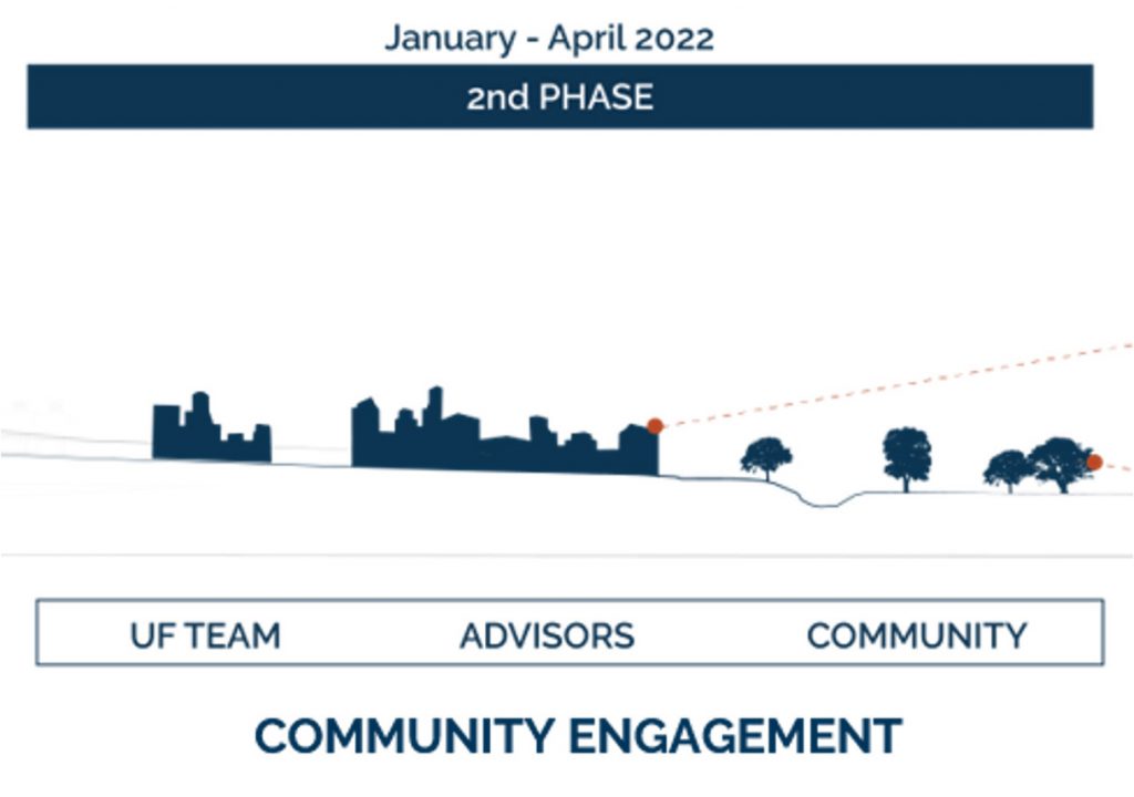
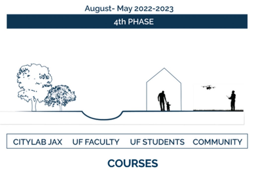
The project unfolds through four interconnected phases, moving from data collection and community engagement to analysis and education. Each phase builds on the previous one, connecting research, local knowledge, and academic learning. Through Socio-Ecological Modeling and Transect Analysis, the research links regional patterns with neighborhood and place-based conditions to better understand and respond to the factors shaping Jacksonville’s urban watersheds and community resilience.
Project Timeline


Phase 01: Socio-Ecological Model
A data-driven approach examining relationships among housing, environmental conditions, demographics, and community well-being to identify interconnected patterns of vulnerability and resilience
The Socio-Ecological Model examines how housing, environmental conditions, demographics, and health outcomes are connected at different levels. The analysis first describes the geographical context of the Jacksonville study area and then uses regional Florida data to identify broader connections between environmental and housing conditions and community health. These regional patterns help provide a foundation for understanding vulnerability within the McCoys and Hogans Creek watersheds.
Geographical Context
The project focuses on vulnerable populations in creek-adjacent neighborhoods within the five-square-mile Hogans and McCoys Creek watersheds, which are part of the new Emerald Trail park and creek restoration project.
Vulnerability across HEH conditions can be reflected in chronic illness, housing insecurity, and other environmental and socioeconomic factors, contributing to persistent inequity (Agyeman, Bullard, & Evans, 2003). Through the Groundwork Jacksonville-led Watershed Plan, the Resilient Jax project seeks to improve future HEH outcomes in these communities. This geographical focus provides the local context for interpreting broader relationships among environmental conditions, housing, and health identified through the regional analysis.

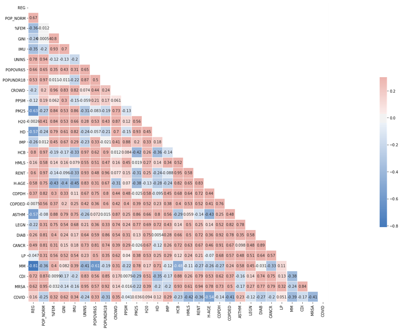
The regional analysis explores how health outcomes relate to environmental and housing conditions. Environmental indicators include air and drinking water quality and extreme heat. Housing indicators include quality, affordability, overcrowding, renting, and housing age. These relationships explain broader vulnerability patterns that inform the localized analysis of Jacksonville’s watershed communities.
Florida Compiled ACHA Regional HEH Correlation Heat Map
The analysis identified several strong positive correlations across housing and health indicators. Notably, rent and MRSA showed a very strong positive correlation (r = 0.94), while housing age and MRSA were also strongly correlated (r = 0.78). Other highlighted relationships include diabetes and housing age (r = 0.71), asthma and housing age (r = 0.75), and MRSA with several housing-related indicators, with correlations reaching approximately r = 0.89. These results highlight measurable associations between housing characteristics and health outcomes across the analyzed Florida regions.
Environmental Quality
Poor Water Quality =
More Respiratory Health Issues?

Click the map to enlarge.
Poor Air Quality =
More Respiratory Health Issues?

Click the map to enlarge.
Poor Air Quality =
Other Health Issues?

Click the map to enlarge.
More High Heat Event Days =
More Respiratory Health Issues?

Click the map to enlarge.
More High Heat Event Days =
Other Health Issues?

Click the map to enlarge.
Housing Conditions and Equity
Poor Housing Quality / Affordability / Age = More Respiratory Health Issues?

Click the map to enlarge.
Poor Housing Quality / Affordability / Age = More Respiratory Health Issues?

Click the map to enlarge.
Poor Housing Quality / Affordability / Age = Other Health Issues?

Click the map to enlarge.
Poor Housing Quality / Affordability / Age = Other Health Issues?

Click the map to enlarge.
Poor Housing Quality / Affordability / Age = Poor Drinking Water Quality?

Click the map to enlarge.
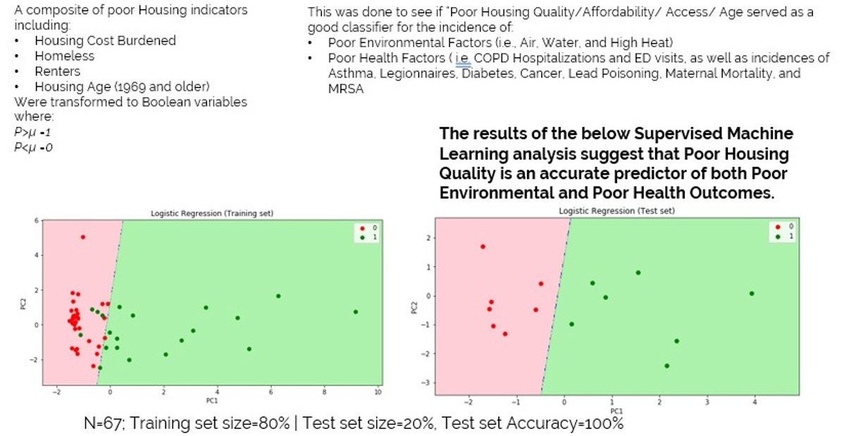
Housing Quality / Affordability / Age as a Predictor of Poor Environmental and Poor Health Factors
Socio-Ecological Model Conclusion
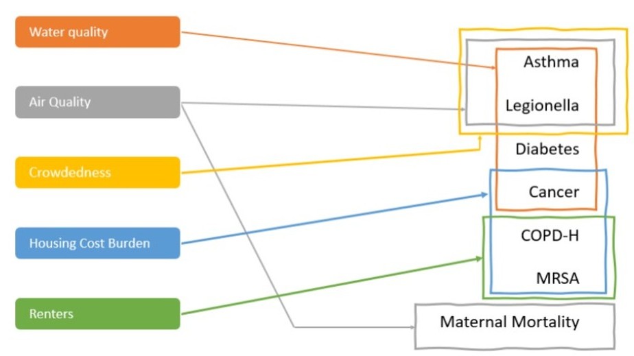
Based on results, the Housing and Health indicators appear to have stronger relationships with Water Quality than Air Quality does with Water Quality. However, Air Quality has strong relationships with Respiratory and other Health Indicators.
Respiratory Health indicators appear to have strong relationships with Housing (Rent, HCB, Crowdedness) and Environment (Water and Air) indicators. This suggests that they are effective for understanding targeted community infrastructure improvement opportunities as it relates to human wellbeing.
Phase 02: Transect Management
Transect analysis helps identify patterns, similarities, and differences across environments by examining physical and human conditions at multiple scales.
Transect analysis uses a geographical cross-section of a region to examine different types of environments and their characteristics. As an affordable and efficient data collection method, it helps identify patterns, similarities, and differences across physical and human conditions, while supporting both horizontal and vertical analysis across multiple scales.
Observing the Neighborhood
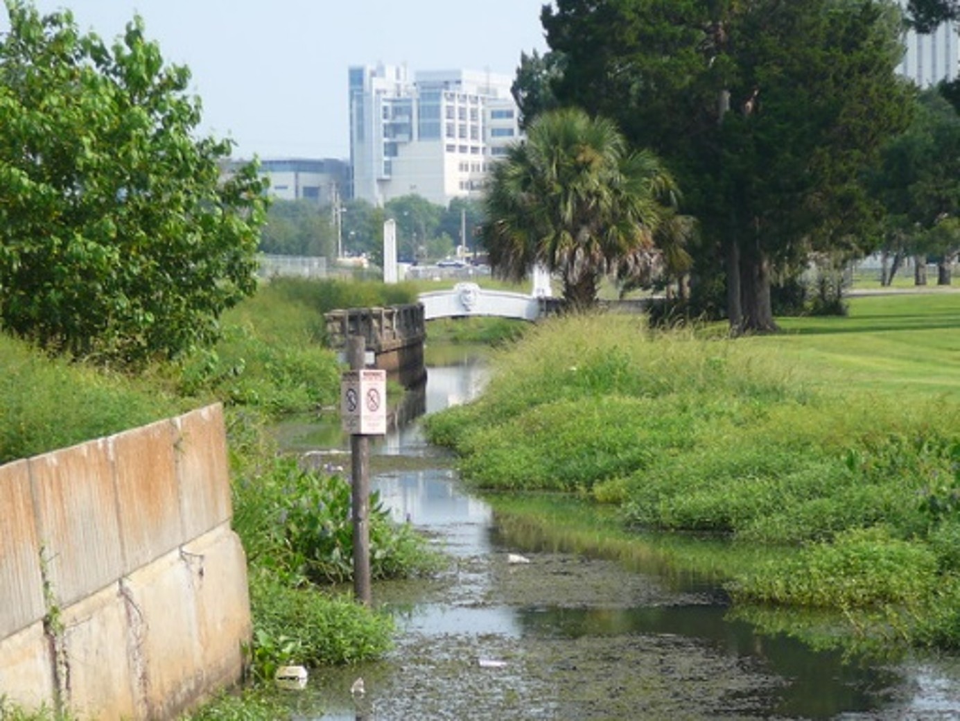
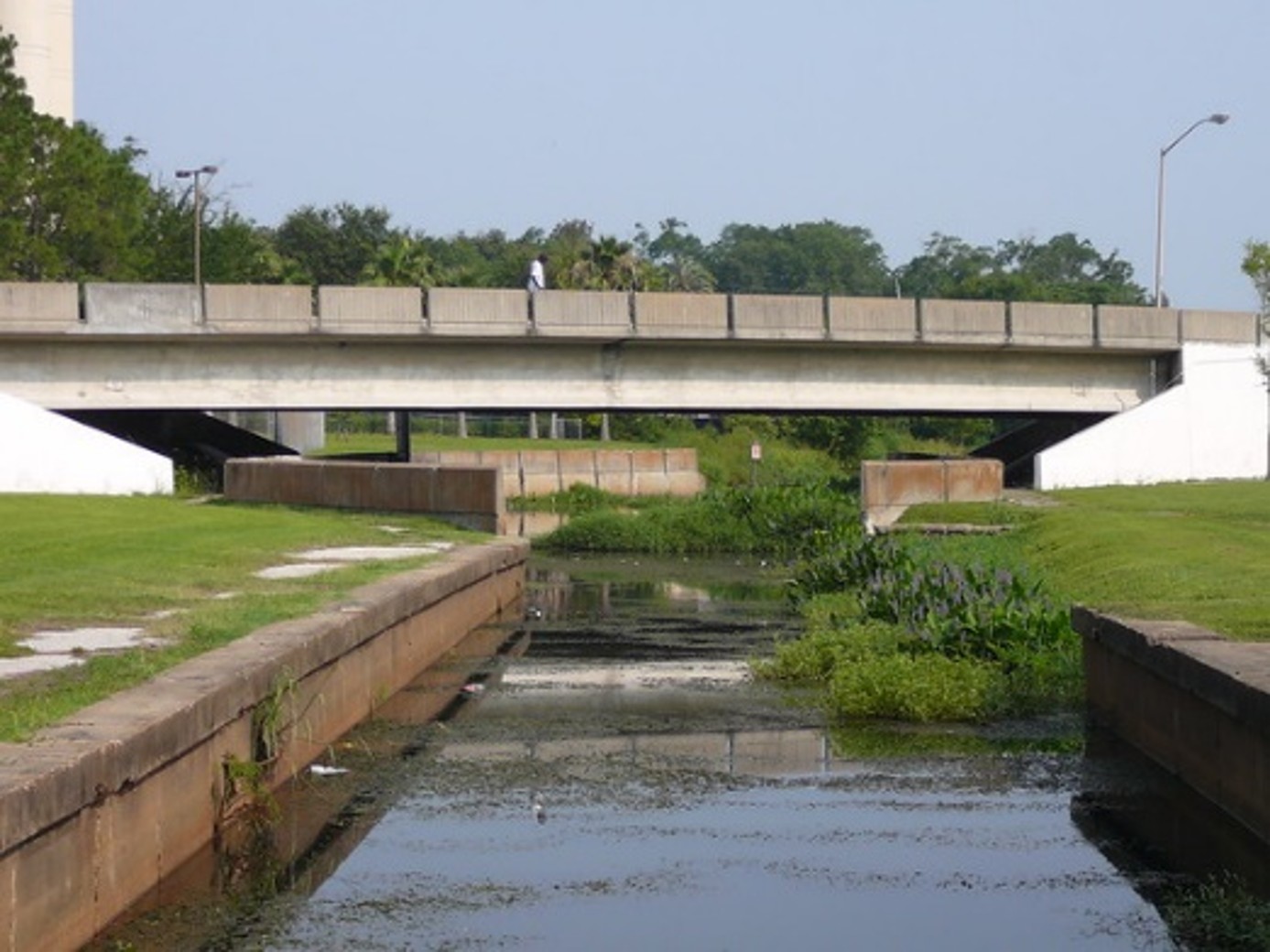
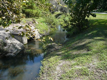
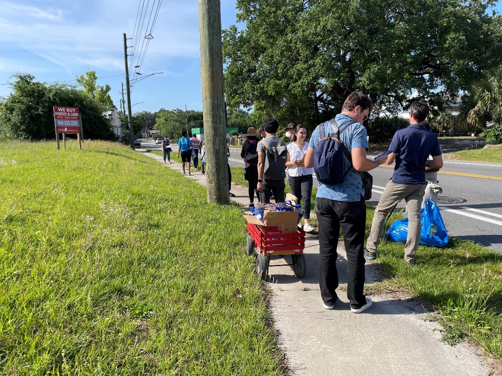
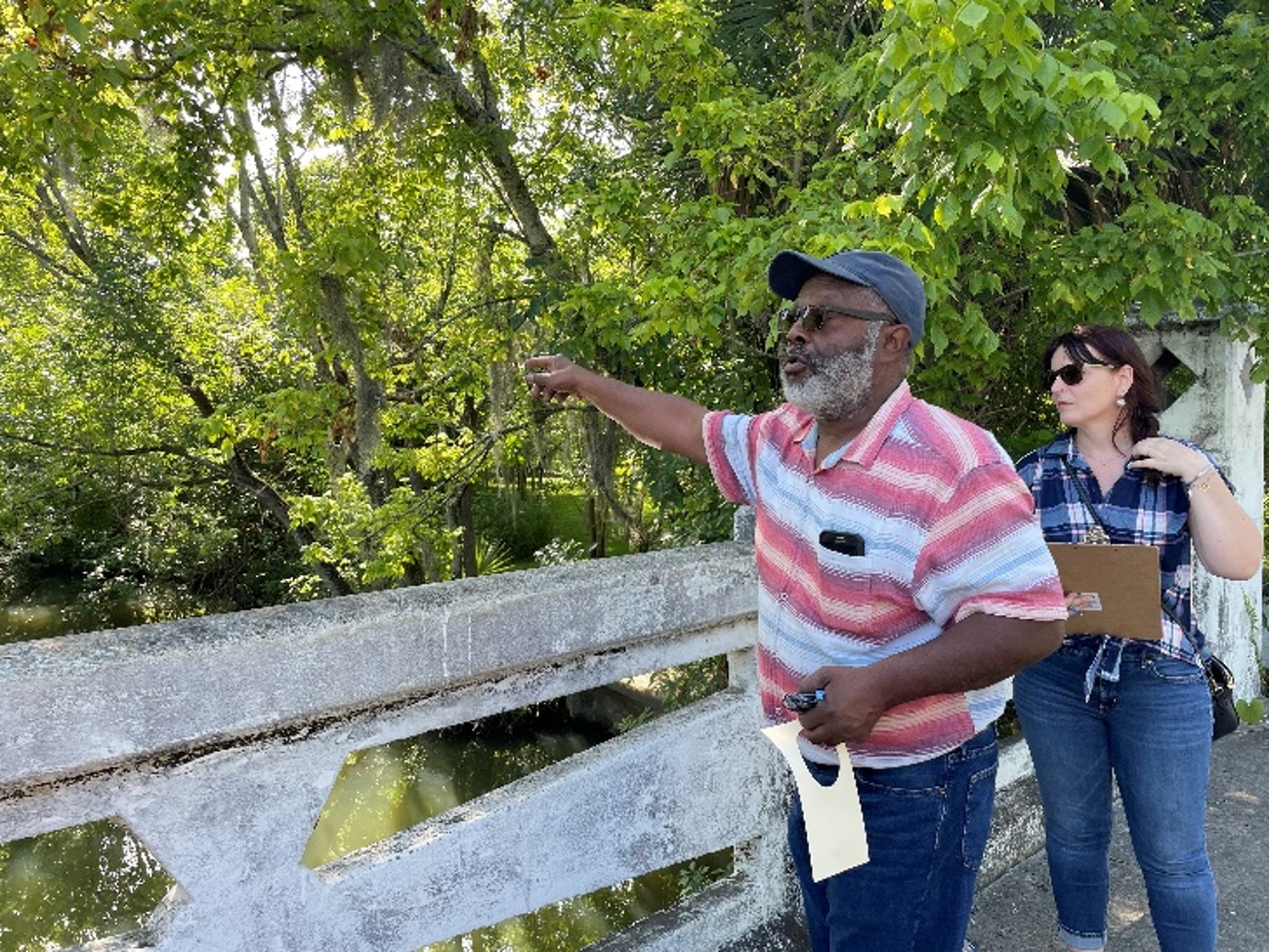
The method is applied through participatory transect walks, where researchers, community members, and local representatives observe and document neighborhood conditions along selected routes. Visual surveys, mapping, field notes, and video documentation capture conditions related to water and flooding, air quality and tree canopy, housing and vacant properties, while oral histories and residents’ experiences help connect these observations to community well-being.
Transect Overview
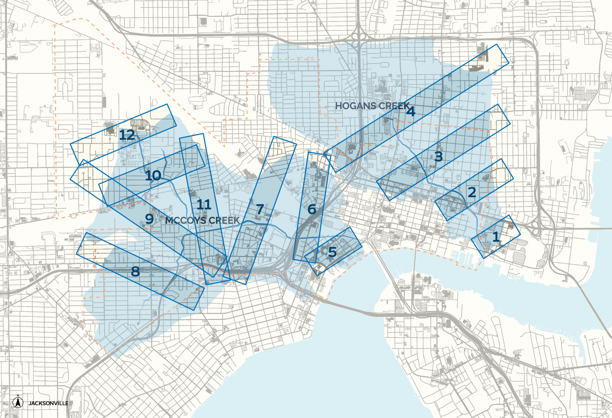
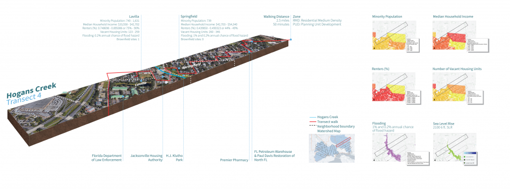
The FRC research team drew 12 transects along Jacksonville’s McCoys creek watershed: 4 transects were perpendicular to Hogans creek and 6 transects were perpendicular to McCoys creek. See two of the following preliminary transects below with their corresponding sociodemographic information for the neighborhoods. Each of the transects are approximately ½ mile apart.
HOGANS CREEK
Transect 1

Click the map to enlarge.
Transect 2

Click the map to enlarge.
Transect 3

Click the map to enlarge.
Transect 4
Click the map to enlarge.
MCCOYS CREEK
Transect 5

Click the map to enlarge.
Transect 6

Click the map to enlarge.
Transect 7

Click the map to enlarge.
Transect 8

Click the map to enlarge.
Transect 9
Click the map to enlarge.
Transect 10

Click the map to enlarge.
Transect 11

Click the map to enlarge.
Transect 12

Click the map to enlarge.
Phase 03: Outreach and Engagement
Phase 03 focuses on organizing and reviewing collected data and community insights to improve future community engagement, strengthen data collection methods, and inform future University of Florida courses.
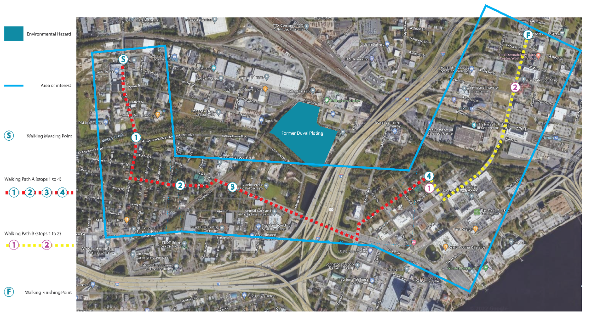
Building on the data and community insights gathered in earlier phases, this phase focuses on organizing and reviewing the findings, including insights from the participatory transect walk through Brooklyn and LaVilla. By documenting residents’ experiences and observations of housing, water, air quality, temperature, and neighborhood change, the walk helps evaluate and improve future data collection and community engagement. These findings also inform future UF courses, connecting research, community experiences, and academic learning in Jacksonville.
Why We Walk
The participatory transect walk aimed to understand residents’ experiences of changes in Jacksonville’s built environment and explore how water quality, air quality, temperature, and housing conditions relate to community well-being.
How We Engaged
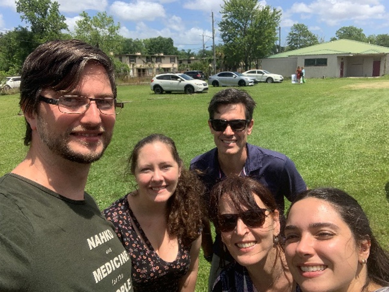
The research team conducted a pilot participatory walk through Brooklyn and LaVilla along two selected transects, working with local partners and residents. The walk combined structured participatory activities and open-ended listening to document neighborhood conditions and gather community knowledge and lived experiences.
Community Walk Route

Project Report
Resilient Jacksonville: Year 1 Report & CE Toolkit
