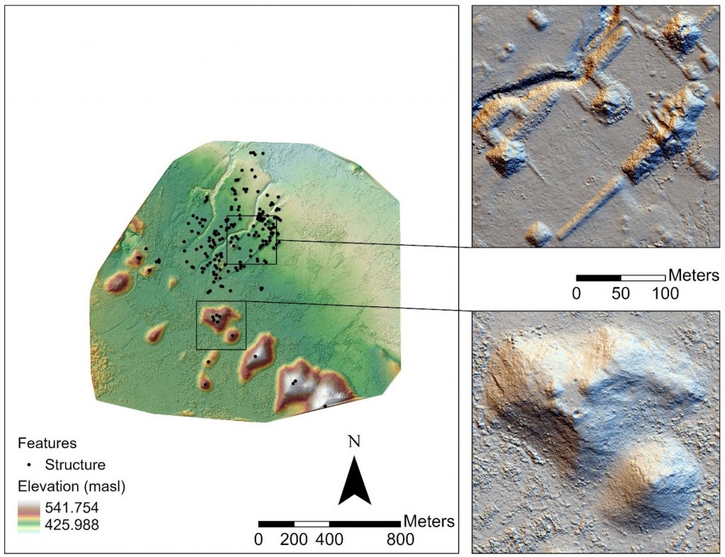
FIBER Postdoctoral Associate Whittaker Schroder and faculty member Timothy Murtha have recently published the article “UAV LiDAR Survey for Archaeological Documentation in Chiapas, Mexico” (https://doi.org/10.3390/rs13234731) in Remote Sensing with collaborators from the University of Florida, Brandeis University, Brown University, and the University of Alabama in Huntsville. This paper presents preliminary results of a pilot project to map archaeological sites and landscapes in southern Mexico with the GatorEye unoccupied aerial vehicle (UAV) system (http://www.speclab.org/gatoreye.html), co-directed by University of Florida researchers Angelica Almeyda Zambrano and Eben Broadbent. Airborne laser scanning has benefited rapid topographic mapping of archaeological resources, especially under vegetation, but applications with UAVs are emerging as a complementary approach to larger scale surveys. In this paper, the authors conducted 6 missions exhibiting a diversity of archaeological features and land cover. This research presents additional opportunities for collaboration among archaeologists and environmental scientists.
Schroder, W., Murtha, T., Golden, C., Scherer, A.K., Broadbent, E.N., Almeyda Zambrano, A.M., Herndon, K., & Griffin, R. (2021). UAV LiDAR survey for archaeological documentation in Chiapas, Mexico. Remote Sensing, 13(23), 4731. https://doi.org/10.3390/rs13234731