TOOLS AND TECHNOLOGY
Learn more about the cutting-edge technology our students, faculty, and collaborators are using.
VISUALIZATION SOFTWARE
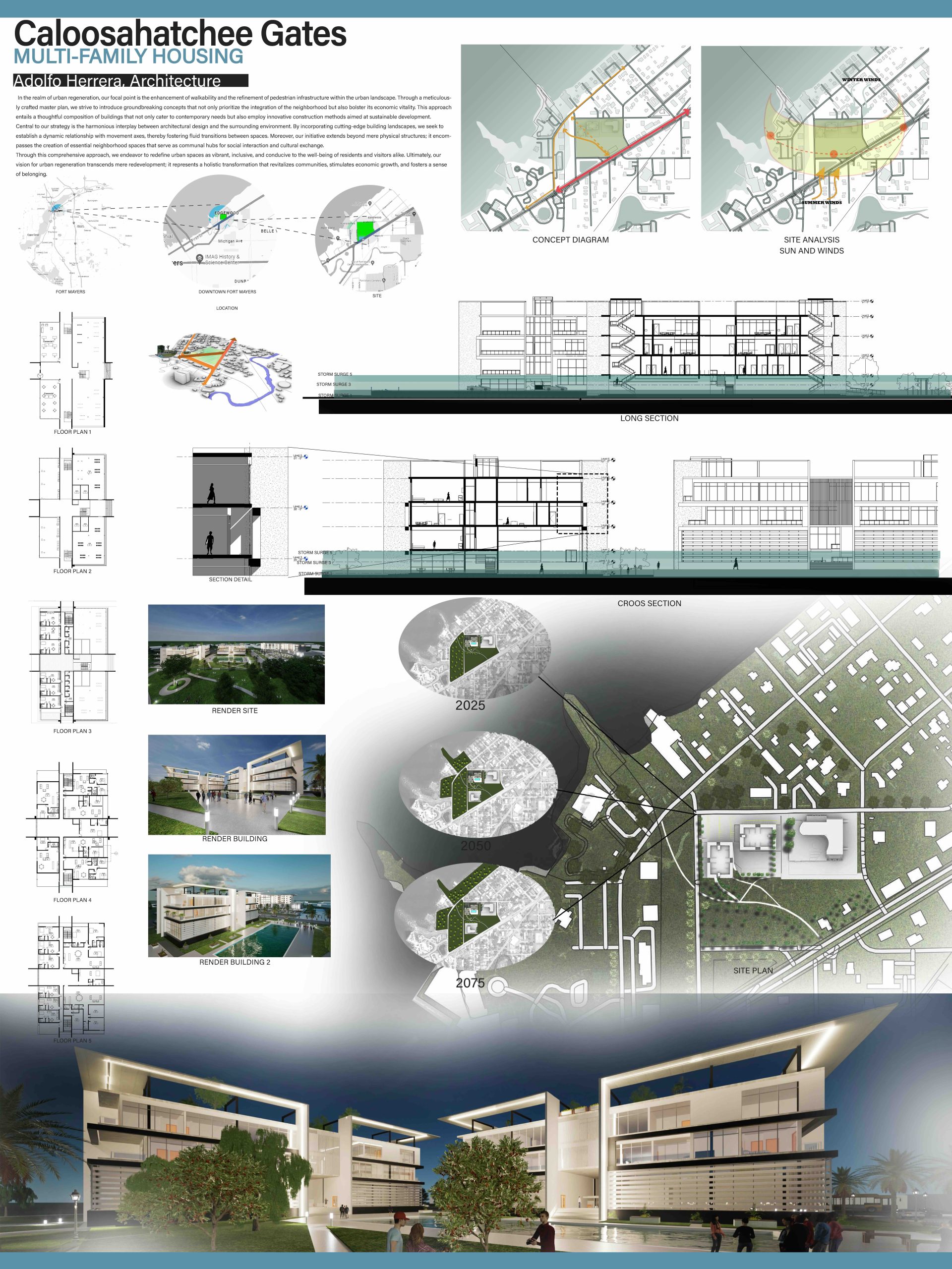
The Gulf South Studio (GSS) also leverages advanced technology to explore resilience and adaptation in the Florida Gulf Coast. Students use advanced geospatial mapping (ArcGIS) tools to assess flood risk, land use, and environmental conditions, which informs data-driven decision-making. AutoCAD and Rhino 3D enable more detailed digital modeling, helping to refine architectural and landscape strategies from concept to detailed design. By applying these technologies in interdisciplinary teams, students gain experience in real-world workflows where various digital tools are integrated into a design process spanning across disciplines. This hands-on experience prepares students to be better prepared for professional practice, equipping them with the skills to develop a more holistic project approach.
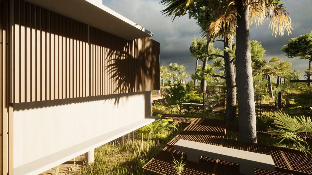
UNREAL ENGINE
Through the use of Unreal Engine (UE), students explore new methods of site analysis and create digital environments replicating Gulf Coast case study sites. With pre-made UE software packages, students generated prototypes of “digital twins” for the case study areas including more realistic and immersive landscapes, vegetation, buildings, sea level rise, etc. Through UE, students gained exposure to artificial intelligence and game engines in architectural and ecological visualization. This experience has been extremely valuable for a number of students. For example, over the past two studios, three of our GSS graduates (architecture) have gone on to work in summer internships or full-time positions with Imerza, a Sarasota-based company specializing in digital twin and immersive VR.